Mission Beach exists because of geography; it also exists because of development.
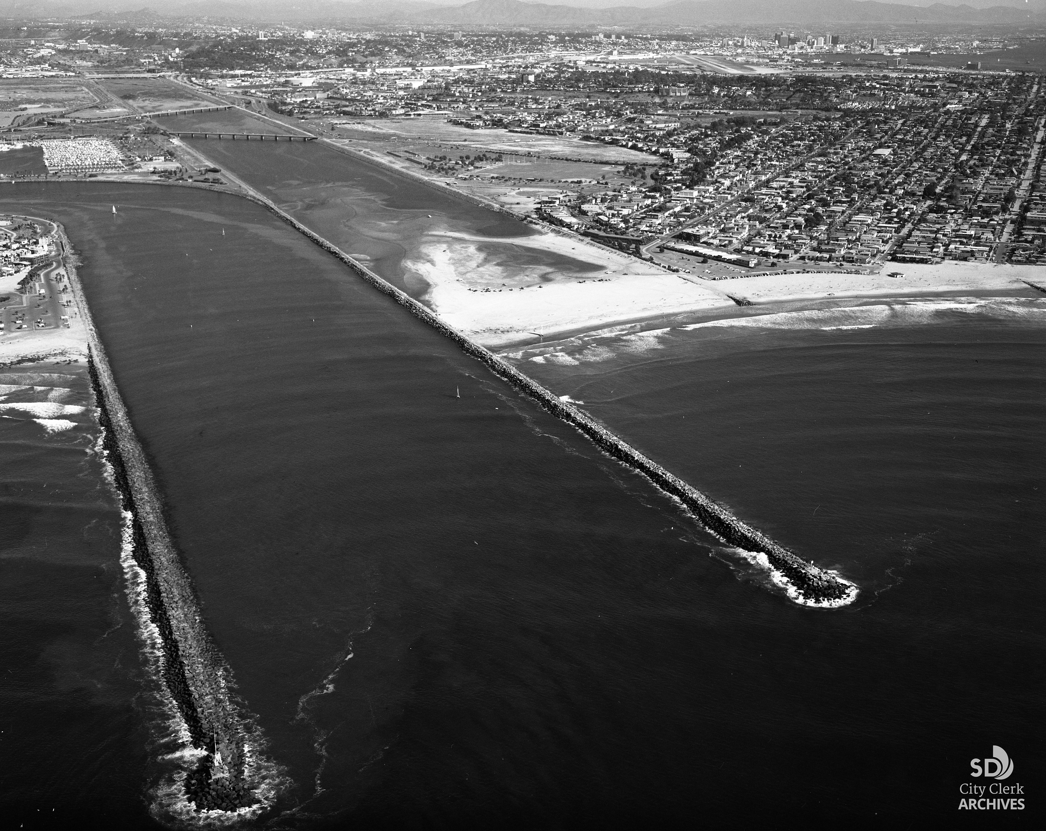
The neighborhood sits on a narrow strip of land between the Pacific Ocean and Mission Bay, a coastal landform that shaped how the area could grow from the beginning.
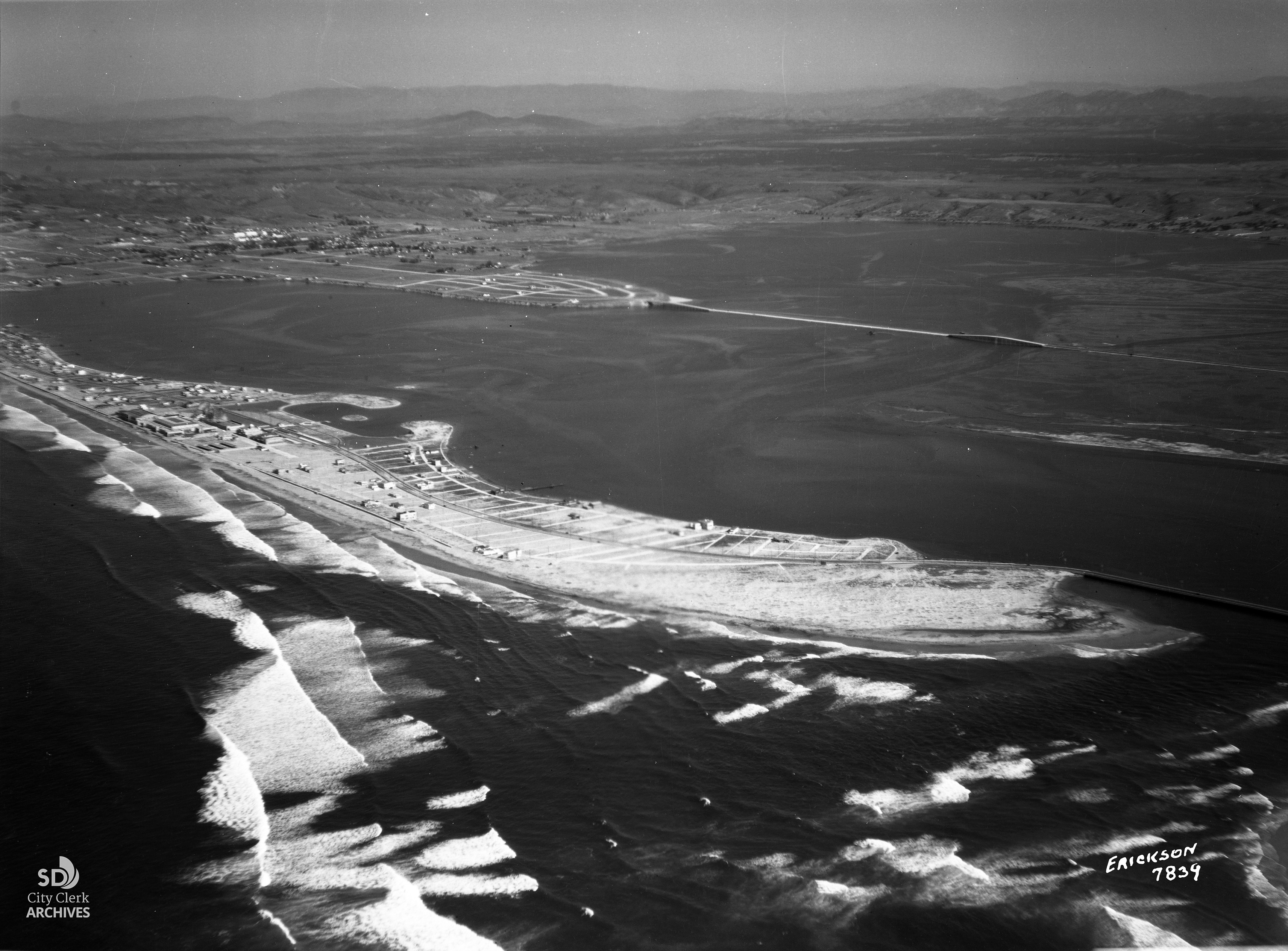
The popular beach developed on a narrow sandy landform shaped over time by wave action, sediment movement, and shoreline processes. Unlike broader coastal plains, the geography limited expansion in both directions. The Pacific Ocean created a fixed western boundary, while Mission Bay formed the eastern edge, confining development to a narrow corridor.


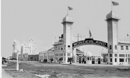
In the early 20th century, the area became part of San Diego’s growing coastal recreation landscape. As shoreline access improved, Mission Beach developed as both a residential neighborhood and a seaside destination. Early on, tents and temporary structures occasionally appeared along the sand, reflecting its use as a seasonal coastal destination before full development. One of the most significant early projects was Belmont Park, which opened in 1925 during a broader era of California coastal amusement park development.

Development patterns were also influenced by transportation access and infrastructure limitations. Road connections and regional accessibility influenced how quickly different parts of the narrow peninsula were developed, contributing to uneven growth along the corridor rather than a single, concentrated district.
On the bay side, Mission Bay originally functioned as a tidal marsh and wetland system. Beginning in the 1940s, large-scale dredging and engineering projects transformed the area into the managed aquatic park environment seen today. The changes reshaped the eastern edge of Mission Beach and reinforced the neighborhood’s position between two distinct waterfront environments.


The result is a built environment defined by limited space. Residential streets, small businesses, and recreational areas exist within a compressed coastal corridor, often with little separation between land uses. Rather than spreading outward into large, separated districts, the neighborhood evolved in a continuous strip along the shoreline.
Today, Mission Beach still reflects those geographic constraints. It remains long, narrow, and densely developed, with much of its identity tied to the physical boundaries created by the ocean, the bay, and the narrow landform between them.
Read more history stories here, and do you have a story to tell? Send an email to DebbieSklar@cox.net.
Sources:
U.S. Geological Survey (USGS) – Coastal geomorphology and barrier systems.
NOAA National Ocean Service – Coastal processes and barrier formations.
City of San Diego – Mission Bay Park history and development overview.
San Diego History Center – regional coastal development context
Belmont Park official historical overview.